
Geology
The geological history of Garda’s moraine hills is ancient and complex. Since the Alpine Orogenesis, which began around 60 million years ago, tremendous tectonic upheavals and extreme climatic changes have engraved the Italian subalpine range, sculpting the landscape into the characteristic shape that can be seen today.
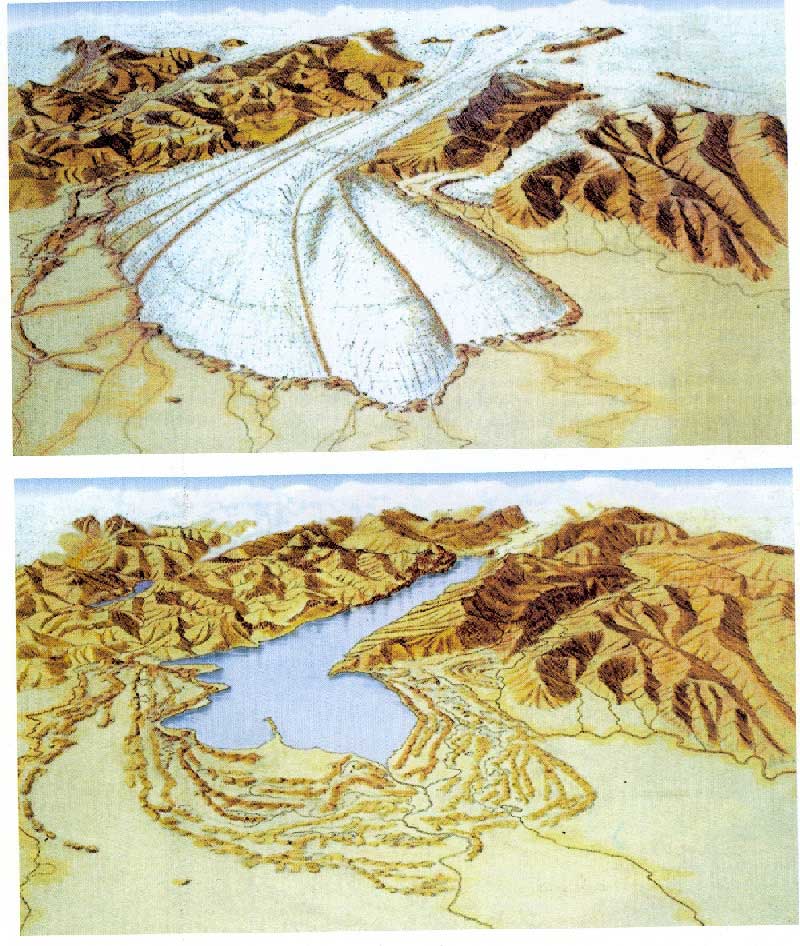
The uplift of the Alpine chain, driven by the push of the African continent, was the primary factor in the formation of the basin that now holds Lake Garda. Later, due to the rapid drop in sea level around 5 million years ago during the Messinian “salinity crisis,” the Sarca-Mincio River, which flowed through the area, further deepened the basin. Subsequently, glacial over-excavation widened the valley and deposited significant amounts of detrital material in the Upper Po Plain.
Specifically, around 2.58 million years ago during the last ice-age, the glacial tongues that ran repeatedly into the open valley eroded the mountains around and the valley floor and deposited the moraine, a massive collection of compressed debris materials which represented the genesis of Garda’s Moraine Hills. Finally, around 12 000 years ago, the rise of the global temperatures led to the melting of the nearby glacier and pooling of its waters in the Benacus basin. Enclosed by the Denervo and Baldo mountains on the west and east side respectively, and by the moraine hills to the south, the greatest lake of Italy was born.